Land Use and Land Cover Prediction in Tamilnadu of India, Using Random Forest Machine Learning Technique
Akila Rajamanickam
*
 and Chandirasekar Kamalakannan
1
Department of Mathematics,
Anna University,
Chennai,
Tamilnadu
India
http://dx.doi.org/10.12944/CWE.20.1.16
Copy the following to cite this article:
Rajamanickam A, Kamalakannan C. Land Use and Land Cover Prediction in Tamilnadu of India, Using Random Forest Machine Learning Technique. Curr World Environ 2025;20(1). DOI:http://dx.doi.org/10.12944/CWE.20.1.16
Copy the following to cite this URL:
Rajamanickam A, Kamalakannan C. Land Use and Land Cover Prediction in Tamilnadu of India, Using Random Forest Machine Learning Technique. Curr World Environ 2025;20(1).
Download article (pdf)
Citation Manager
Publish History

Introduction
Environmental and socio-economic growth are greatly influenced by changes in land use and land cover (LULC). Among other factors, population increase, urban expansion, deforestation, climate change, and agricultural intensification influence LULC changes. While land use relates to human activities and changes on the land, such as agriculture, forestry, and urbanization, land cover reflects the physical and biological traits of the ground surface.1,2 Rapid urbanization in many developing countries, for example, transforms agricultural and forested areas into built-up zones, therefore affecting biodiversity, water supplies, and climate adaptation measures.3-5 Researches shows that sustainable land management and disaster risk reduction depend on correct LULC forecasts.6,7 Changes in Land Use and Land Cover (LULC) greatly influence environmental management, urban planning, and sustainable development.
LULC changes have well-documented effects on natural resources as well. Spatial LULC dynamics, for example, are directly related to groundwater recharge as well as levels. Research in the Hat Yai Basin demonstrates how tools like QGIS-based MOLUSCE software provide critical insights for sustainable water resource management.8 Similarly, the impact of LULC on soil properties and carbon sequestration has been evaluated in the upper Himalayan region, underlining the interplay between land cover variations and ecosystem carbon storage.9,10 Additionally, sustainable land resource use amidst changing LULC patterns highlights the need for tailored strategies in diverse geographical contexts.11,12
Much research shows how policies influence LULC alterations. Land regulation policies have played a critical role in restricting agricultural land conversion to construction land. By employing advanced remote sensing data (30 m resolution) and analytical methods, the study provides valuable insights for enhancing farmland protection programs and ecological land planning to address growing construction land demands in the Beijing Tianjin Hebei region. This findings contribute to informed policymaking for sustainable land management in regions experiencing rapid urbanization.13,14 In a similar context, comparative analyses of classification algorithms in detecting LULC changes have revealed the utility of advanced techniques like machine learning in improving classification accuracy and understanding climatic impacts of land transformations.15,16
One-third of the population of India lives in cities.17 To look for work and create their life in cities, people from the Tamil Nadu state and other neighboring states, as well as millions of North Indian states, have moved from rural Urbanization in India rose from 27.7% to 31.1%, a 3.3% increase between 2001 and 2011.18, 19 Urbanization causes Indian cities to suffer unclean health conditions and environmental degradation.20 Among the fifteen main states mentioned by India, Tamil Nadu came first in urbanization. Based on the 2001 census, the state has reached the highest degree of urbanization at 43.86% in the nation.21 Approximately 27 million people call the metropolitan city of Tamil Nadu home.22 Tamil Nadu's urbanization pattern is scattered with towns in practically every district.23 Rapid urbanization in Tamil Nadu creates several problems, including deforestation, water shortage, floods, pollution, and other environmental damage.24
Remote sensing and GIS tools enable researchers to assess changes and guide sustainable management strategies effectively.25,26 The evolution of Geographic Information Systems (GIS) and remote sensing has significantly improved LULC research. Satellite pictures from sources such as Landsat, Sentinel, and MODIS offer multi-temporal data sets, allowing scholars to categorize land cover kinds and study temporal changes.27-30
By combining satellite-based LULC data from the National Remote Sensing Centre (NRSC) with machine learning techniques, this research enhances understanding of LULC trends in Tamil Nadu, a state known for its diverse geographical and land-use characteristics.
Though machine learning (ML) techniques have demonstrated better performance in capturing complex patterns in large datasets, traditional statistical models have been extensively used for LULC classification. LULC studies make extensive use of algorithms, including Random Forest (RF), Artificial Neural Networks (ANN), Support Vector Machines (SVM), and Convolutional Neural Networks (CNN).31,32 Particularly the RF algorithm has become more well-known for its strength in managing high-dimensional data, lowering overfitting, and generating precise forecasts.33,34
Urban planning, resource management, and environmental sustainability are all significantly impacted by changes in land use and land cover (LULC). Over the past few decades, Tamil Nadu, an area in India that is rapidly becoming more urbanized, has seen significant changes in land use. Uses CA Markov models and remote sensing and to analyze urban growth and LULC changes over 140 years in the Coastal Districts of Northern Tamil Nadu. This study highlights the impact of urbanization on coastal ecosystems.35 Examines LULC data from 2005 to 2016, focusing on urbanization, agricultural decline, and forest cover reduction in Tamilnadu. This study emphasizes the need for sustainable land management.36 Using Random Forest algorithms, a study maps LULC changes over two decades, analyzing vegetation and land surface temperature impacts in Tamilnadu.37 Employing QGIS MOLUSCE plugin and MLP-ANN models, this research forecasts LULC changes for 2025 and 2030 at Bhavani Basin in Tamilnadu, showing significant increases in cropland and built-up areas.38 The study uses geospatial techniques to monitor LULC changes, revealing shifts in agricultural and urban areas over several years in Salem District.39
There aren't many predictive models that use sophisticated AI-driven techniques to evaluate LULC changes over several years in Tamilnadu, despite the fact that many studies concentrate on retrospective LULC analysis and short-term projections of some areas in Tamilnadu. These papers emphasize the increasing need for including sophisticated computational methods for precise LULC prediction in Tamilnadu.
This paper aims to examine the LULC changes using machine learning for spatial analysis, therefore guaranteeing that data-driven insights direct land development policies.
An in-depth analysis of Tamil Nadu, a state in southern India renowned for its diverse land use and geography, Random Forest (RF) machine learning model is used in this study to forecast future land cover changes for the years 2024 to 2028 by analyzing historical LULC trends using NRSC satellite data from 2005 to 2023. The findings of this research will aid in sustainable land management, environmental conservation, and urban planning across Tamil Nadu. The correlation coefficient evaluates the performance of the model.
Materials and Methods
Study Area
This study was carried out in Tamil Nadu, research was conducted in Tamil Nadu, a southern Indian state with a seashore bordered by one dimension and a variety of landforms including hilly terrain, marshes, and forests.40, 41 This paper offers a thorough examination of Tamil Nadu, a southern Indian state famous for its varied topographical and land use traits. Geographically located between latitudes 8°04' N and 13°35' N and longitudes 76°14' E and 80°21' E, Tamil Nadu covers 130.06 lakh hectare.42 Andhra Pradesh and Telangana border it to the north; Karnataka to the northwest; Kerala to the west; the Bay of Bengal to the east; the Indian Ocean to the south.43
Data Collection
The dataset is obtained from the National Remote Sensing Centre (NRSC) is used in this study. and covers the period from 2005 to 2023.44 Among the many land use and land cover (LULC) categories included are built-up areas, agricultural land (Kharif, Rabi, Zaid crops, double/triple annual crops, current fallow), plantations, various kinds of woodlands (evergreen, semi-evergreen, deciduous, degraded), wetlands, grasslands, wastelands, and water bodies (maximum and minimum spread).
Satellite photos, GIS-based land use maps, and supplementary data from government reports and research papers provide the basis for the data gathering.45 The analysis emphasizes a territory covered by NRSC's LULC datasets spanning 2005 to 2023. The dataset includes several different land cover kinds, as shown in the Table 1.
Table 1: Different Land Cover Kinds
Built-Up Areas | Urban and rural settlements encompassing residential, commercial, and industrial areas that have experienced notable growth throughout time. |
Agricultural Land | It encompasses a variety of cropping patterns, including Kharif (monsoon crops like rice and maize), Rabi (winter crops like wheat and mustard), and Zaid (summer crops like watermelon and cucumber). Additionally, double/triple annual cropping systems indicate regions with intensive farming practices. |
Plantations and orchards | The area is cultivated with tree plantations such as rubber, coconut, tea, coffee, and orchards producing fruits like mango, apple, and citrus varieties. |
Woodland categories | Evergreen/Semi-Evergreen woodlands. Forests with dense canopy cover are found in areas receiving high rainfall Deciduous woodlands. Found in moderate to dry climate zones, trees that shed leaves annually. Degraded woodlands. These are places where human encroachment, overgrazing, or deforestation have caused forests to decline. |
Wetlands and water bodies | Mangroves, swamps, and littoral Biodiversi-ty and climate control depend on coastal and interior wetland areas. And inland wetland regions are crucial for biodiversity and cli-mate regulation. |
Water bodies (maximum and minimum spread) | All of which show changes in water avail-ability, this category includes seasonal and perennial lakes, reservoirs, and rivers. |
Grasslands and wastelands | Grasslands. Often utilized for grazing and ecological preservation, open land ruled by natural or cultivated grasses. Wastelands. Wastelands are deteriorated lands that are unfit for farming, including rocky, sandy, or barren places with scarce vegetation. |
Preprocessing of Data
Data cleaning was done first to eliminate duplicate and missing records and to handle missing data using interpolation techniques like forward-fill and linear interpolation. Moving average techniques were used to smooth the variability in satellite-derived data in order to improve the visualization of LULC patterns.
Random Forest Regression
Operating as an ensemble of decision trees, A method of machine learning is random forest regression. A many tree trained on several dataset components, their forecasts aggregated to generate a final output, decision tree regression was extended by Random Forest Regression. Using the "wisdom of crowds" method, this strategy increases generalization and decreases overfitting. Every tree in the forest was constructed from a random choice of data points and features, hence guaranteeing variation in the model. Averaging the outputs of all trees produces the last prediction; hence Random Forest Regression was very accurate and robust for forecasting continuous numerical values, such land use and land cover changes over time.
Random Forest Prediction (Final Output)
Each tree in the forest made a prediction yi, and equation (1) used to find the final prediction was the average of all tree outputs.
![]()
Where T = Number of decision trees in the forest and yi = Prediction from each tree.
Predicting continuous values is done using a non-parametric supervised learning technique called Decision Tree Regression. At every stage, it recursively divides the dataset into smaller areas, hence reducing the Mean Squared Error (MSE). The last forecast is based on the average of the target values in every area.
Equation (2) gives the mean value of the target variable y as
![]()
yi= Target value for each data point, N = Total number of data points
Equation (3) measures the Mean Squared Error (MSE) gives the variance within a region before and after splitting
![]()
yi = Actual target value, y = Mean of target values in the region
To evaluate a potential split, equation (4) computes the weighted MSE as
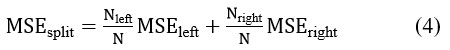
Nleft , Nright = Number of data points in left and right nodes, MSEleft , MSEright= MSE of left and right child nodes
Rolling Prediction Approach Using Random Forest Regression
Predicting land use and land cover (LULC) changes in Tamilnadu, India, throughout the years from 2018 to 2028, this paper used Random Forest Regression's recursive rolling prediction technique. Initially trained on historical data from 2005 to 2017 in Tamilnadu, India, the model forecasts LULC for 2018 in Tamilnadu, India. The dataset is then filled with the projected LULC values for the year 2018, and the model is retrained to forecast LULC for the year 2020 in Tamilnadu, India. Ensuring a progressive estimation of future land cover changes, this iterative procedure carries on using both real historical data and prior forecasts. Figure 1 shows a schematic depiction of the methodological framework applied in this investigation.
To check if the suggested Random Forest model is correct, we calculate prediction accuracy, mean absolute error (MAE), and correlation coefficient (R), accuracy percentage for the years where we have real data, like 2018, 2020, 2021, 2022, and 2023. This validation ensures reliability before making long-term predictions for 2024–2028. Before projecting long-term for 2024–2028, this validation guarantees dependability. Interpretation is helped by visualizations such projected LULC distributions, pie charts, and bar charts for actual vs. expected values. While reducing independent annual estimation errors, this stepwise prediction technique offers a systematic way to examine future LULC changes.
 | Figure 1: Methodology for Predicting Land Use and Land Cover in Tamilnadu, India.
|
Mean Absolute Error
Ignoring direction, equation (5) gives the Mean Absolute Error (MAE) measures the average size of discrepancies between projected and actual values. It offers a clear way to gauge how near predictions are to actual observations. A lesser MAE indicates a more accurate model.
![]()
Where, n = Total number of observations , Ypredicted,I = Predicted land cover value for the i-th observation and Yactual,i = Actual land cover value for the i-th observation.
Accuracy.
Regarding land use and land cover forecasting, The accuracy provided by equation (6) is the percentage of valid model predictions for the actual data. It provides a broad evaluation of how well the model reflects the observed LULC trends. A high accuracy % shows that the projections of the model closely match the real land cover changes, hence enabling it to estimate future trends. On the other hand, low accuracy indicates notable forecast mistakes that call for model changes.
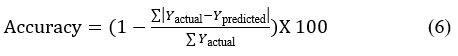
Where Yactual= Actual land cover values and Ypredicted= Predicted land cover values
Kappa Coefficient
The Kappa coefficient is a statistical measure of agreement between the predicted land cover classes and the actual observed data in the context of land use and land cover (LULC) prediction; it also considers the agreement that could arise by chance. Unlike simple accuracy, which only considers the proportion of correct predictions, equation (7) gives the Kappa coefficient provides a more rigorous evaluation of model performance, particularly in cases where class distributions are imbalanced.
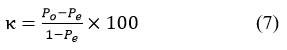
Where:
Po = Observed agreement (i.e., the proportion of correctly predicted land cover types)
Pe = Expected agreement by chance (calculated based on the distribution of predictions and actual values)
A high Kappa value shows a substantial agreement between the expected and actual classifications, signifying that the model performs well beyond random chance. On the other hand, a low or negative Kappa score indicates that the predictions of the model are not consistently better than random guessing, and improvements are needed to enhance classification quality.
Producer's Accuracy
Producer's Accuracy is calculated using Equation (8), which measures the classifier's ability to accurately identify instances in the real (ground truth) data belonging to a certain class. It computes the proportion of accurately forecasted cases for a particular class relative to the total number of cases of that class in the actual data.

Where:
True Positives for Class: The number of data points that belong to a specific class and are correctly predicted as that class.
Total Actual Instances for Class: The actual number of data points belonging to that class—the ground truth.
User's Accuracy (for data)
User's Accuracy, as defined by Equation (9), is the capacity of the classifier to accurately forecast a particular class when it designates that class to a data point. It computes the proportion of correct predictions for a particular class relative to the total number of cases forecasted as that class.

Where:
True Positives for Class: The amount of data points accurately forecasted to fit a certain class.
Total Predicted Instances for Class: The total amount of data points the classifier predicted would belong to that class.
Implementation Using Python
Python was used for all data processing, model training, and visualization in this work. Data processing was done using Pandas, visualisation using Matplotlib and Seaborn, and machine learning-based forecasts using Scikit-Learn. Python scripts streamlined the whole process from data preparation to accuracy assessment, hence guaranteeing consistency and reproducibility.
In order for machine learning algorithms to process LULC datasets efficiently, categorical labels like "Forest," "Urban," "Agriculture," or "Water Bodies" must be transformed into numerical values. Categorizing numerical values (for example, "Forest" - 0 and "Urban" - 1)
The class distributions in LULC datasets are frequently unbalanced, with some land categories (like urban areas) having an overrepresentation and others (like wetlands or forests) having an underrepresentation. Assign higher weighing to minority classes like forest and wetland to reduce bias toward majority land categories in LULC models
Results
Empirical Analysis of Land Use and Land Cover
Comparing actual and projected Land Use and Land Cover (LULC) values for various land in Tamilnadu, India, for the years 2018, 2020, 2021, 2022, and 2023 is shown in Fig. 2
With projected values in most cases nearly matching actual values, the model efficiently reflects LULC distribution across several categories. The minor differences imply that the Random Forest Regression model is consistent in forecasting significant LULC changes.
Model Performance Evaluation
The performance of the Random Forest Regression model was assessed using an empirical analysis of Land Use and Land Cover (LULC) data of Tamilnadu, India, from 2018 to 2023. Predictions' correctness was confirmed by means of the Correlation Coefficient (R), Mean Absolute Error (MAE), and correctness. Table 2 summarizes the predictive accuracy of the Random Forest model.
The model's performance, assessed using the Mean Absolute Error (MAE), Correlation Coefficient (R), and Accuracy (%), shows notable increases in prediction dependability. While the declining MAE implies improved accuracy, a greater R-value shows a significant correlation between actual and anticipated values. The rising accuracy rate emphasizes the model's increasing capacity to capture LULC trends.
Table 2: Random Forest model’s predictive accuracy
Year | Correlation Coefficient (R) | Mean Absolute Error (MAE) | Accuracy (%) | Kappa Coefficient | Producer's Accuracy (%) | User's Accuracy (%) |
2018 | 0.75 | 3.220 | 62.858 | 0.667 | 64.52 | 70.24 |
2020 | 0.96 | 1.864 | 78.502 | 0.833 | 87.32 | 96.41 |
2021 | 0.969 | 1.286 | 85.172 | 0.823 | 65.77 | 82.33 |
2022 | 0.986 | 1.201 | 86.144 | 0.919 | 81.5 | 98.32 |
2023 | 0.979 | 1.039 | 88.018 | 0.893 | 83.69 | 87.23 |
The accuracy for the year 2018 was relatively low and improved in later years by Rolling Forecast Method. Regularly revising the forecast as new data becomes available, the Rolling Forecast Method is a continuous forecasting technique that uses historical data to project future performance over a given period. User accuracy, producer accuracy, and the kappa coefficient calculated on referenced data were used to examine the accuracy of the identified LULC. The Kappa statistics shows that the strong agreement between the predicted LULC and the actual data of Tamilnadu, India, from 2018 to 2023. Producer’s Accuracy (PA) shows that LULC categories (e.g., urban areas, wetland, forest) are correctly classified and User’s Accuracy shows reliability of predicted LULC for each class.
The consistent improvement across these measures verifies the strength of the Python-based machine learning approach. The reduction in Mean Square Error and rise in Accuracy percentage indicate effective data preprocessing and model optimization.
 | Figure 2: Comparing actual and predicted LULC values for different land categories in Tamilnadu, India, for the years 2018, 2020, 2021, 2022, and 2023.
|
These results validate the Random Forest model's reliability for LULC forecasting. Further enhancements, such as incorporating additional spatial and temporal data, could further improve prediction accuracy. The approach ensures a strong foundation for future land use analysis.
Future LULC Predictions in the years from 2024 to 2028
The future Land Use and Land Cover (LULC) forecasts in Tamilnadu, India, for the years from 2024 to 2028 have been generated by means of a Python-based machine learning approach combining historical LULC patterns with advanced predictive modeling techniques. These forecasts provide critical insights into expected land cover transformations, aiding urban planning, environmental management, and sustainable land use strategies. Table 2 below presents the predicted LULC values for different land categories of Tamilnadu, India, from the year 2024 to 2028.
These projections highlight possible changes in agricultural land, urban expansion, forest cover, and water bodies in Tamilnadu, India, supporting decision-making for sustainable development and conservation efforts.
Future LULC Distribution
Pie charts for each projected year from 2024 to 2028 have been produced to help one see these LULC variations over time. Figure 3 shows the percentage contribution of every LULC category, hence enabling a better knowledge of land cover changes and possible future trends in Tamilnadu, India. These visualizations assist in spotting patterns and trends in land cover changes, which are vital for environmentalists, urban planners, and legislators in making educated choices. Predictive accuracy can be improved by further modifications, including remote sensing data, socio-economic considerations, and climatic variables, therefore offering more in-depth knowledge of future land use possibilities.
Table 2: predicted LULC values (in hectares) for different land categories in Tamilnadu, India, from the years 2024 to 2028
LULC Category (L ha) | 2024 | 2025 | 2026 | 2027 | 2028 |
Built-up | 6.13 | 6.13 | 6.131 | 6.132 | 6.133 |
Kharif Crop | 11.734 | 11.677 | 11.677 | 11.67 | 11.635 |
Rabi Crop | 17.87 | 18.079 | 18.224 | 18.334 | 18.45 |
Zaid Crop | 0.982 | 0.98 | 0.989 | 0.993 | 0.987 |
Double/Triple/Annual Crop | 34.21 | 34.11 | 33.98 | 33.863 | 33.805 |
Current Fallow | 15.623 | 15.62 | 15.61 | 15.61 | 15.59 |
Plantation/Orchard | 10.08 | 10.071 | 10.076 | 10.081 | 10.079 |
Evergreen/Semi-Evergreen woodland | 5.516 | 5.516 | 5.516 | 5.516 | 5.516 |
Deciduous woodland | 15.389 | 15.385 | 15.38 | 15.38 | 15.39 |
Degraded woodland | 1.307 | 1.305 | 1.303 | 1.303 | 1.303 |
Littoral/Swamp/ Mangroves | 0.082 | 0.082 | 0.082 | 0.082 | 0.082 |
Grassland | 0.649 | 0.648 | 0.646 | 0.645 | 0.64 |
Wasteland | 4.043 | 4.038 | 4.037 | 4.039 | 4.045 |
Waterbodies max spread | 5.256 | 5.271 | 5.266 | 5.264 | 5.278 |
Waterbodies min spread | 1.186 | 1.15 | 1.13 | 1.121 | 1.119 |
 | Figure 3: Predicted LULC Distribution in Tamilnadu, India for the years 2024, 2025, 2026, 2027 & 2028
|
Discussion
The LULC shift two-decade study in Tamil Nadu reveals notable urban area growth and fallow landscape monotonicity as well as a considerable drop in farmland and plantation agriculture landforms. Most of these changes result from individuals migrating from the rural areas to the towns in Tamil Nadu, particularly Chennai, Coimbatore, Trichy, and Madurai, seeking employment by abandoning their own estates, hence making agricultural lands barren and comparable owing to high demand. Urban-fringes are sold and mapped, therefore generating settlements that cause urbanization.46 When compared to earlier studies. Liping et.al,1 found the trends in Tamil Nadu are in line with patterns of urbanization and land abandonment seen in China and Nepal, where land use is being reshaped by population increases, urbanization, agricultural expansion, and climate change. Effective land resource management and planning depend on monitoring and forecasting these shifts. Rapid urban expansion sometimes turns agricultural land and woods into built regions, consequently upsetting ecological balance and food supply. Sustainable land management policies so rely on exact projections of LULC trends. As remote sensing and machine learning techniques have advanced, predictive modeling has been a helpful tool for analyzing LULC trends. This paper aims to predict future LULC changes by applying the RF model using historical LULC patterns in Tamil Nadu from the year 2005 to 2023. Classification accuracy is evaluated using Producer’s Accuracy, User’s Accuracy and Kappa coefficient, Comprising first forecasting LULC from the year 2018 to 2023 and verifying it against actual data, and second projecting LULC from the year 2024 to 2028 across Tamilnadu. GIS tools allow spatial data processing, hence allowing high accuracy display and modeling of LULC changes. This paper investigates how well the Random Forest (RF) classifies land cover in the Tamilnadu. By including satellite-based LULC data from the National Remote Sensing Centre (NRSC), this work serves to enhance land-use planning and environmental protection initiatives.
Conclusion
The findings show notable urban development, a steady drop in double/triple cropping areas, stable but slightly declining forest cover, and water body spread oscillations. A Random Forest Regression model for forecasting Land Use and Land Cover (LULC) changes in Tamil Nadu, India, was trained and validated using satellite data from the National Remote Sensing Centre (NRSC) between 2005 and 2023, therefore attaining great accuracy with a correlation coefficient (R > 0.97) and lowering Mean Absolute Error (MAE). Results indicated significant urban development, a decline in double/triple cropping areas, slightly diminishing forest cover, and fluctuating water body spread, reflecting the impacts of urbanization, agricultural practices, and environmental shifts in Tamilnadu. Strict governmental policies should be followed to minimize the consequences of landform change since it is beyond control in poor countries to convert agricultural or forest land into impermeable layers. Some initiatives, like the Conversion of Cropland to Forest Program (CCFP), can be implemented in line with this one; farmers who take part in these programs may get subsidies. These programs can benefit communities that are moving to urban areas for a variety of reasons and gaining more ecosystem values. These findings provide crucial insights for environmentalists, urban planners, and policymakers, supporting sustainable land management and climate adaptation strategies in Tamil Nadu. Future research should incorporate climate factors (rainfall, temperature) and socio-economic data (population growth, economic development) to better capture human-driven LULC changes and improve predictive accuracy. Also, using deep learning techniques like CNN, LSTM, and ensemble learning, along with advanced GIS spatial analysis and heatmap visuals, can improve predictions and spot areas at high risk for urban growth or deforestation, helping make better decisions for sustainable land use and protecting the environment.
Acknowledgement
This research was made possible by my student Chandirasekar Kamalakannan, Master of Mathematics, Anna University, Chennai, Tamilnadu, India. I would like to thank my student Chandrasekar. K., who worked and generously shared their ideas with me.
Funding Sources
The author(s) received no financial support for the research, authorship, and/or publication of this article.
Conflict of Interest
The authors do not have any conflict of interest.
Data Availability Statement
satellite-derived data from the National Remote Sensing Centre (NRSC)
Ethics Statement
This research did not involve human participants, animal subjects, or any material that re-quires ethical approval.
Informed Consent Statement
This study did not involve human participants, and therefore, informed consent was not re-quired.
Permission to reproduce material from other sources
Not Applicable
Author Contributions
Akila Rajamanickam: Funding Acquisition, Resources, Supervision, Review & Editing, Visualization, Supervision, Project Administration
Chandirasekar Kamalakannan: Conceptualization, Methodology, Writing – Original Draft, Data Collection, Analysis, Writing
References
- Liping C., Yujun S., Saeed S. Monitoring and predicting land use and land cover changes using remote sensing and GIS techniques—a case study of a hilly area, Jiangle, China. PLOS ONE. 2018;13(7).
CrossRef - Turner BL., Meyer WB., Skole DL. Global land-use/land-cover change: towards an integrated study. Environmental Science. 1994;1(2):123-145.
- Arfasa GF., Owusu-Sekyere E., Doke DA. Predictions of land use/land cover change, drivers, and their implications on water availability for irrigation in the Vea catchment, Ghana. Geocarto Int. 2023;38(1):1-23.
CrossRef - Long H., Tang G., Li X., Heilig GK. Socio-economic driving forces of land-use change in Kunshan, the Yangtze River Delta economic area of China. Journal of Environmental Management. 2007;83(3):351-364.
CrossRef - Mark M., Kudakwashe M. Rate of land-use/land-cover changes in Shurugwi district, Zimbabwe: drivers for change. Journal of Sustainable Development in Africa. 2010;12(3):107-121.
- Mishra V., Rai P., Mohan K. Prediction of land use changes based on land change modeler (LCM) using remote sensing: A case study of Muzaffarpur (Bihar), India. Journal of the Geographical Institute. 2014;64(1):111-127.
CrossRef - Prakasam C. Land use and land cover change detection through remote sensing approach: A case study of Kodaikanal taluk, Tamil Nadu. Advances in Remote Sensing. 2010;15(3):45-60.
- Ali D., Hussain A., Begum F. Assessing the impact of land use and land cover changes on soil properties and carbon sequestration in the upper Himalayan region of Gilgit, Pakistan. Environmental Chemistry One World. 2025;5:100038.
CrossRef - Zhang L., Qu W., Li X., Du H. Effect of land use and land cover change on ecosystem service value of Northeast Sandy Land in China. Sustainability. 2025;17(1):167.
CrossRef - Foley JA., DeFries R., Asner GP., Barford C., Bonan G., Carpenter SR. Global consequences of land use. Ecosystem Studies. 2005;12(4):570-574.
CrossRef - Jahanbakhsh M., Esmaeily A., Pour AB. Spatio-temporal assessment of land use and land cover dynamics in Urmia lake basin of Iran: A bi-directional approach using optical and radar data on the Google Earth Engine platform. Advances in Space Research. 2025;17(3):1299-1313.
CrossRef - Bisht BS., Kothyari BP. Land-cover change analysis of Garur Ganga watershed using GIS/remote sensing technique. Indian Remote Sensing Journal. 2001;29(3):137-141.
CrossRef - Zeng L., Yang L., Su L., Hu H., Feng C. The impact of policies on land use and land cover changes in the Beijing–Tianjin–Hebei region in China. Environmental Impact Assessment Review. 2025;110:107676.
CrossRef - Lambin EF., Turner BL., Geist HJ., Agbola SB., Angelsen A., Bruce JW. The causes of land-use and land-cover change: moving beyond the myths. Global Environmental Change. 2001;11(4):261-269.
CrossRef - Nuthammachot N., Ali MZ. Comparative study of multiple algorithms classification for land use and land cover change detection and its impact on local climate of Mardan district. Environmental Challenges. 2025;18:101069.
CrossRef - Singh A. Review article digital change detection techniques using remotely-sensed data. International Journal of Remote Sensing. 1989;10(6):989-1003.
CrossRef - Ermida SL., Soares P., Mantas V., Göttsche FM., Trigo IF. Google earth engine open-source code for land surface temperature estimation from the landsat series. Remote Sensing. 2020;12:1471.
CrossRef - Padmanban R., Painho M. Urban agent-based model of urban slum Dharavi, Mumbai, India. Journal of Earth System Science and Engineering. 2017;2:1110.
- Dandona L., Dandona R., John RK., McCarty CA., Rao GN. Population-based assessment of uveitis in an urban population in southern India. British Journal of Ophthalmology. 2000;84:706-709.
CrossRef - Anees MM., Shukla R., Punia M., Joshi PK. Assessment and visualization of inherent vulnerability of urban population in India to natural disasters. Climate Development. 2020;12(2):532-546.
CrossRef - Wu DCN., Banzon EP., Gelband H., Chin B., Malhotra V/, Khetrapal S. Healthcare investments for the urban populations, Bangladesh and India. Bulletin of the World Health Organization. 2020;98(1):19-29.
CrossRef - Anuradha B., Iyappan L., Partheeban P., Jaganmogan K., Hariharasudan C., Palanikumar K. Statistical study on area cultivated in peri-urban and rural tanks during pre and post rehabilitation. International Journal of Agricultural Statistics Science. 2020;16:883-888.
- Mohanraj R., Sathishkumar M., Azeez PA., Sivakumar R. Pollution status of wetlands in urban Coimbatore, Tamil Nadu, India. Bulletin of Environmental Contamination and Toxicology. 2000;64:638-643.
CrossRef - Kiruthiga K., Thirumaran K. Effects of urbanization on historical heritage buildings in Kumbakonam, Tamil Nadu, India. Frontiers of Architectural Research. 2019;8(2):94-105.
CrossRef - Ologunde OH., Kelani MO., Biru MK., Olayemi AB. Land use and land cover changes: A case study in Nigeria. Land. 2025;14(2):389.
CrossRef - Sala OE., Chapin FS., Armesto JJ., Berlow E., Bloomfield J., Dirzo R. Global biodiversity scenarios for the year 2100. Biodiversity Studies. 2000;287(5459):1770-1774.
CrossRef - Raguraman N., Bhardwaj A. Spatial analysis of land use land cover dynamics in the Madurai District using Sentinel-2 Data and supervised learning algorithms. International Archives of Photogrammetry, Remote Sensing, and Spatial Information Sciences. 2024;4:367-372.
CrossRef - Adeniyi PO., Omojola A. Landuse/landcover change evaluation in Sokoto-Rima basin of NW Nigeria based on archival remote sensing and GIS techniques. Remote Sensing and GIS Applications. 1999;8(2):87-93.
- Dhinwa PS., Pathan SK., Sastry SVC. Land use change analysis of Bharatpur district using GIS. Indian Society of Remote Sensing Journal. 1992;20(4):237-250.
CrossRef - Xiaomei Y., RongQing LQY. Change detection based on remote sensing information model and its application to the Yellow River Delta's coastal line. Earth Observation. 1999;5(1):77-85.
- Pal M. Random forest classifier for remote sensing classification. International Journal of Remote Sensing. 2005;26(1):217-222.
CrossRef - Javed A., Khan I. Land use/land cover change due to mining activities in Singrauli industrial belt, Madhya Pradesh using remote sensing and GIS. Journal of Environmental Research and Development. 2012;6(3A):122-134.
- Vinayak B., Lee HS/, Gedem S. Prediction of land use and land cover changes in Mumbai City, India, using remote sensing data and a multilayer perceptron neural network-based Markov chain model. Sustainability. 2021;13(2):471.
CrossRef - Turner BL.;, Lambin EF., Reenberg A. The emergence of land change science for global environmental change and sustainability. Proceedings of the National Academy of Sciences. 2007;104(52):20666-20671.
CrossRef - Abijith D., Saravanan S. Assessment of land use and land cover change detection and prediction using remote sensing and CA Markov in the northern coastal districts of Tamil Nadu, India. Environmental Science and Pollution Research. 2022;29:86055-86067.
CrossRef - Sushmitha S., Chandrashekara B. Temporal evolution of land use patterns in Tamil Nadu: A satellite-based analysis. GEO-EYE. 2023;12(2):49-53.
CrossRef - Shamsudeen M., Padmanaban R., Cabral P., Morgado P. Spatio-temporal analysis of the impact of landscape changes on vegetation and land surface temperature over Tamil Nadu. Earth. 2022;3(2):614-638.
CrossRef - Kamaraj M., Rangarajan S. Predicting the future land use and land cover changes for Bhavani basin, Tamil Nadu, India, using QGIS MOLUSCE plugin. Environmental Science and Pollution Research. 2022;29:86337-86348.
CrossRef - Arulbalaji P. Analysis of land use/land cover changes using geospatial techniques in Salem district, Tamil Nadu, South India. SN Appl Sci. 2019;1:462.
CrossRef - Tariq A., Shu H. CA-Markov chain analysis of seasonal land surface temperature and land use/land cover change using optical multi-temporal satellite data of Faisalabad, Pakistan. Remote Sens. 2020;12:3402.
CrossRef - Cabral P., Feger C., Levrel H., Chambolle M., Basque D. Assessing the impact of land-cover changes on ecosystem services: A first step toward integrative planning in Bordeaux, France. Ecosyst Serv. 2016;22:318–327.
CrossRef - Kiruthiga K., Thirumaran K. Effects of urbanization on historical heritage buildings in Kumbakonam, Tamil Nadu, India. Front Archit Res. 2019;8:94–105.
CrossRef - GEE EarthEngine Data Catalog. Available online: https://developers.google.com/earth-engine/datasets/catalog/ (accessed on 4 January 2020).
- Geist H., McConnell W., Lambin EF., Moran E., Alves D/, Rudel T. Land-Use and Land-Cover Change. Springer. 2006;Berlin Heidelberg, Germany.
- Indian Geo Platform of ISRO. Available online: https://bhuvan-app1.nrsc.gov.in. . Published February 21, 2025. Accessed February 21, 2025.
- Balk D., Montgomery MR, Engin H., Lin N, Major E., Jones B. Urbanization in India: Population and urban classification grids for 2011. Data. 2019;4:35.
CrossRef


